By Martin Hain, Save the Sound Communications Specialist
Has there ever been a summer we’ve all been more acutely aware of our own health and the health of those around us? But even now, few give a second thought when plunging into their local river or beach for a refreshing swim or reeling in a fish and serving it up for their family’s dinner. The health of the waters that you swim in, boat on, and fish from can directly affect your personal health, however, and Save the Sound has made it our mission to bring you the best data possible so you can make informed decisions about your health.
Every year from spring through fall—and often at the break of dawn—Save the Sound’s Water Quality team goes to work out on the water. Even with the challenges to fieldwork that COVID has posed, the team is out there responding to pollution reports, collecting and testing water samples, and publishing detailed reports. We turn all that information into online tools for you to use to better understand the health of Long Island Sound and the waterways around you.

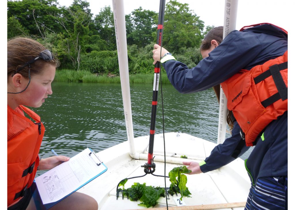
Ash Creek Conservation Association volunteers sample macrophytes in the waters between Bridgeport and Fairfield, CT. © savethesound.org
Our largest monitoring program is the Unified Water Study (UWS). Launched in 2017, this coordinated Sound-wide effort includes twenty-three organizations, using a standardized water quality monitoring protocol we developed so groups around Long Island Sound can collect comparable data on the environmental health of our bays and harbors. Historically, local water monitoring has been done by a variety of groups using many different approaches, which made it extremely difficult to accurately compare data from one inlet to another. Under the leadership of Save the Sound, the UWS is generating apples-to-apples data for Sound bays that will provide a roadmap for conservation efforts and investments.
Each year since the project’s founding, Save the Sound has released the data collected as a downloadable spreadsheet. This was great for the science-minded, but left the general public scratching their heads. The detailed records aren’t easy to interpret if you don’t know what you’re looking for. So this year, the data has been analyzed and compiled using a grading system developed by Save the Sound and its science advisors Jamie Vaudrey, Ph.D. and Jason Krumholz, Ph.D. in order to make the reams of numbers more understandable for the public and for the local and state officials who make environmental policy and infrastructure spending decisions. These “grades” have been incorporated into our recently released 2020 Long Island Sound Report Card and the recently revamped Sound Health Explorer online data visualization tool.
Sound Health Explorer is a great way for anyone of any age to explore the health of the Swimmable, Fishable, and Livable areas of Long Island Sound. If you’re a beachgoer, the Swimmable section has grades back to 2004 for over 200 beaches around the Sound that are monitored for safe swimming conditions throughout the warmer months. Like to cast a line or sail a boat? The Fishable section grades the bays, harbors, and open waters of the Sound on conditions that support a healthy environment for life to thrive in. Livable refers to the places we as humans choose to live, and this section shows how sea level rise, flooding, and coastal erosion are likely to affect shoreline communities, and how these changes will affect our quality of life and safety.
But it’s not just about information—it’s also about action. Our goal is to empower every person in the Long Island Sound region to understand their local water quality, the unique challenges and solutions of their community, and how to make lasting change for an environment that’s thriving and healthy for all. To explore the health of Long Island Sound, and learn how you can take action, visit SoundHealthExplorer.org.
To learn more about the Unified Water Study and the participating groups, please visit savethesound.org/water-monitoring-ecological-health. The 2020 Long Island Report Card can be found at soundhealthexplorer.org/explore/reports/■
